The actual geological feature that we hiked along last weekend (HuangDi Dian) ended at a town called ShiDing. The town is situated in a valley, beside a river that cuts through this ridge line. This weekend we went back to the same town to continue the ridgeline, this time away from town. We were supposed to be able to hike straight along the ridge to another town of MaoKong, but as is always the case with us and the Taiwanese maps and directions, we ended up in a totally different, yet still magnificent area. We started fresh in the morning, made it to the ridge and spent a hefty 5-ish hours exploring before starting our downward trek off the ridge and to the valley below.
This whole section is astounding, with views and actual trails that make our hearts sing. Perfect weather, perfect hike....and we ended it all with a stop at a tea shop along the walk home and then the obligatory celebratory pizza and pint.
View along the way...
So many choices....trails sprouting off of each other along the way.
The first part of the hike was all uphill, through thick, yet penetrable, tropical brush. I can imagine in teh summer this would be a veritable sweat-fest!
More ropes (and ladders and chains and more ropes) to help people along the cliff sections, and in all honesty these are so needed. We are fine on most stuff in Taiwan, but some of these sections really, especially after a healthy rainfall, need some sort of safety. To the left of this picture is a sheer cliff...we are walking actually on a few roots (of the big tree there) that ran parallel along the rock face and gathered soil throughout the years. So....we are walking on a pseudo-trail with notheing below but air to stop us!
Morning, pre-coffee and pre-cereal, in our Taipei hostel room. Cheap, convenient and clean.


ShiDing, the town with the trailhead! To the left a man takes away the refuse from the tofu shop, dried bean fibre essentially. Cant figure out if they do anything with it, or if it becomes pig feed. What we do know is that it most likely doesn't go to waste...not in Taiwan. On the right, one of the various ways they write the name for the trail - same trail had different chinese characters on the signs along the way to the trailhead...oh, Taiwan, you adorable confusing place!! Also note the sign above which denotes the next place of interest is but 3.8 kilograms away.


Early section of the trail, walking through the forest for a short while brought us to an opening and a small farm/garden. This is an aspect of Taiwanese hiking that comforts us so often...the trail meanders along epic ridgelines and perilous valleys of sloppy soil and randomly pops out at a little village or garden or something. The people there are ever so happy to guide us on our way to the continuation of the trail, and in this case the grandfather motioned us along his property and to the corner of his house where the trail began again...smiles and a nod goodbye, he helped us along the way. This plant on the right is a very tastey number that I dont know the name of yet, but always a delight to eat (albeit a little daunting to cook right!).


I learned about 'cauliflory' in Taiwan, and love pointing it out to myself each time I see a tree exhibiting it. So freaking cool! On the right, a typical trail marker in Taiwan.


Crystal takes a pause along the way to adore the view, while two massive mosquitoes do their best to make baby mosquitoes on the exposed root of a tree.
The ridge itself is not a totally exposed rocky cliff as much as the HuangDi Dian trail was, but still offers epic views and a hearty workout. With the sunshine and wind working together, it ended up being one of those perfect days - not too hot, not too cold. And clear views.


Both of us along the ridgeline...it was forested with multiple open areas. Nice view along the entire length.

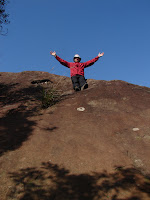
On top of the world! A peak along the ridge...sunshine and the sky above.


Crystal at lunch. Another delicacy we created for the road - carrots and homemade buns! And a __?__ insect we spotted along the way.


Along the trail...scrambling along roots and up roped sections which were, um, a little messy at times. Best of intents, worst of outcomes?
The trail was nice and dry, with only a few muddy spots along the way. The best part were the rope sections which are made easier by knowing that it was the mountain association that put them in, but always gives us a few scares when we see exactly what trees (or branches or shrubs or ...) the ropes are actually affixed to! Mostly they are secure, but there is that odd one that make us shake our heads. For the longer hauls op the cliff faces or steep sections that we cant see around, we hope for the best.


